Information

En los primeros tramos la etapa transcurre junto a la vía del tren
This is for many walkers is the first stage of the Camino de Santiago, given that Sarria is where the highest percentage of pilgrims decide to begin their journey to Santiago.
The day is not as inferior for those pilgrims beginning their journey as for those who already have many kilometres behind them. The route moves away from the road and enters the more rural Galicia, from one of the most beautiful carballeiras (oak woods) on the itinerary. Passing a number of Romanesque remnants and several Jacobean enclaves, rustic walkways and an early medieval bridge. It is a simple itinerary, with achievable kilometres and moderate slopes, and only in heavy rain, mud generated on dirt trails, may cause some sections to become difficult to pass.
Throughout the whole journey pilgrims will find no problem in acquiring supplies. It is also the stage that has kept the most memoirs from the Xacobeo'93, and its famous mascot Pelegrin, as well as a number of more spontaneous shrines made by walkers. Many of which put the pilgrims taste into question.
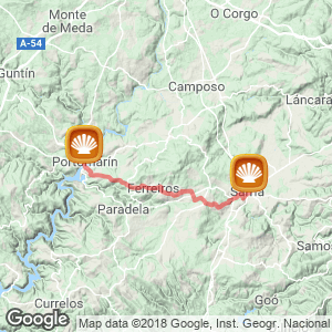
The step (21.6 kilometres)
The day starts in Rúa Maior de Sarria (115.5 kilometres to Santiago), the starting point for many pilgrims.
After passing the church, iglesia de Salvador and a former prison (which was used by walkers as makeshift shelter for decades), they arrive at a viewing point with a cross to bid farewell to this town of Lugo. Two tall buildings detract from the beautiful panoramic view. Leaving behind, on the left the old wall, where the vía cruces (A series of twelve crosses representing the last steps taken by Jesus) can still be appreciated and inside the tower fort is still preserved.
After a slight ascent and subsequent descent on asphalt the route arrives at the hostel-convent A Magdalena. Of roman origin, although with Gothic and even masculine elements, founded in the early XII century as a hospital for pilgrims. It provided assistance to those travelling to Compostela, but not those returning, they were received at the hospital of San Anton, currently a court. Now at the bottom, they should turn right and reach, on a stretch of asphalt the bridge Ponte Aspera, of medieval origin, next to which there is a resting area. The bridge, of three arches and built from ashlar slate, crosses the river Celeiro. After crossing, not without some difficulty because its pavement is full of potholes, they reach the first stretch on an earthy track, which, like the rest after a long periods of rain can become very muddy.
The trail continues parallel at first the railway line. After nearly a kilometre it passes through a number of meadows and on uneven ground with loose medium size stones, hikers should therefore cross over to the other side. The crossing Passes under a viaduct below the motorway, it is well signposted, so locating it should not be a problem.
Immediately, the path, still on earthy ground, turns to the left and at a crossroads, narrows and leads to a wooden walkway that prevents walkers from getting wet by the stream. At this point the toughest slope of the stage begins, quite long but that in exchange it allows pilgrims the opportunity to enjoy a beautiful carballera (oak wood). Now on flat ground they reach As Paredis, an enclave of pre-Roman origin that still preserves a tower from its medieval fortress. The itinerary does not pass by many establishments providing services, although those needing refreshments will find at a crossroads the first of several drinks machines that are dotted along the stage.
After an open path among meadows and fields, walkers quickly reach Vilei (18.8 kilometres to Portomarín) where there are an abundance of services. This is one of the most populated centres of the day. Here walkers will find the comprehensive hostel Casa Barbadelo and a covered resting area with a number of different machines selling food and drinks, it is also possible to purchase batteries and pilgrim walking sticks as well as receive the stamp for the credential. It has to be said that the constant attempts to encourage hikers to stop here can break from the tranquillity sought by many of them. Just outside this place there is a fountain and two wooden benches where they can eat more peacefully.
Barbadelo
With little more than 500 meters remaining to reach the historic centre of Barbadelo (18.1 kilometres to Portomarín) a Galician parish mentioned in the Codex Calixtino as a passing place to reach Santiago. It was also, according to legends of that time, the place where the workers of restaurateurs from Compostela tricked pilgrims by recommending inns where they were later scammed.
After leaving Vilei, and exceeding a cross on the left that leads to another private hostel, O Pombal, the asphalt path reaches Mosterio, where the beautiful temple of Barbadelo is situated (with a drinks machine) and, just opposite, the public hostel.

Albergue Casa Barbadelo
The Church of Santiago, a great example of Galician Roman architecture (X century), noted both for its structure and the uniqueness of its capitals, it was declared a national monument in 1976. Its history runs parallel to the Camino. Centuries ago it formed part of the monastery of Samos, and functioned as a hospital for pilgrims. Furthermore, its Jacobean connection is made evident by the scallop shell that enhances one side of its facade as well as the image of Santiago the pilgrim on its Baroque altarpiece.
At this point hikers can continue on the path that leaves the public hostel on the right or can go up a slope leaving the hostel on the left and guides them to the small chapel of San Sylvester and to A Casa de Carmen, one of the most rural enclaves recommended to those wanting to stay overnight.
According to the locals this point on the Camino is known as aneiro, which basically means that one year the Camino takes one route, and the following year it takes the other alternative, both routes are on good ground. Those walkers passing through A Casa de Carmen will find a drinking fountain.
Mercado da Serra
Now with both trails reunited the itinerary continues on a well-maintained path that leads to Rente, (16.7 kilometres to Portomarín) an enclave with two rural houses (Casa Caxigueiro and Casa Nova) in which all services are offered to walkers. Continuing, and after some stretches on an earthy path they reach Mercado da Serra (16.2 kilometres to Portomarín), where in the Middle Ages they celebrated a medieval market. The Jews would come here from Portomarín to negotiate and supply the pilgrims. The path then passes the LU-5709 without a pedestrian crossing. There are two establishments on this road, that offer the hikers meals, sandwiches, drinks, stamps as well as a tobacco shop and Internet access. Following the Camino route at this stage can be a little difficult, however if walkers pay close attention to the signs there should be no problem.
The path continues through a corridor of trees, situated opposite the previously taken path. A little later, and at a junction with a road, another sign for a bar appears. The bar called Casa Sita, also serves food, to reach the establishment walkers must deviate 200 meters from the route, which many do.
After passing a noisy fountain crowned by Pelegrín (the Jacobean mascot of 1993), the route reaches, less than a kilometre after the Mill of Marzán (built in 1920). Turn right and then after an ascent, hikers should cross a stream via a bridge made of stone slabs. If done in times of heavy rain, this section of the Camino can become very muddy.
Soon after, the route crosses the LU-633, without a pedestrian crossing. After passing two vending machines selling drinks and fruit juices, they arrive to Leiman (14.2 kilometres to Portomarín) and, a little further ahead to Peruscallo (13,2 kilómetres to Portomarín), a beautiful rural enclave with some barns and with services for hikers, such as a bakery selling artisan bread, sandwiches, mini pizzas and coffee, there is also a small yet well provisioned shop selling everything from raspberries to walking sticks for pilgrims.
At this moment the route travels through an area of streams, with passing areas and stepping-stones as well as several sections along earthy paths with potholes and ruts, making it difficult to maintain a steady pace. This constant change in terrain every few sections is a distinctive feature of the day. On a path accompanied by chestnut and oak trees with traces of the ancient road they will access Cortiñas, (12.4 kilometres to Portomarín), Lavandeira (11, 9 kilometres to Portomarín) and, now on an asphalt road and after passing cobblestone sections to reach Brea, where walkers should not be confused by the first and incorrect milestone announcing 100 kilometres to Santiago. The correct milestone is not the one situated at the beginning of a slope, but rather the one on a flat path of asphalt. This area is also recognizable by the large amount of painted arrows on the route and treasured memories. It is one of the most emblematic sections of the pilgrimage route since it is the minimum distance covered by pilgrims walking to Compostela. It also serves as a significant boost to the countdown along the Galician section of the Camino. After resuming the footpath the ground becomes more compact, once again small streams invade the route and are passed from one side.

Alberge-bar en Morgade
Now on asphalt Morgade is reached (10.5 kilometres to Portomarín), one of the places where many walkers stop to replenish energy at a spacious bar located at the foot of the Camino with a terrace and menus for pilgrims. In the centre they will also find a fountain (known as Fonte do Demonio-The devils fountain) and the small chapel of the Trinity, a temple where hikers leave notes detailing their Jacobean experience.
The footpath then faces another slope invaded by a stream, where only a few slabs of granite, which are sometimes covered by water, help walkers to cross. From here they access Ferreiros (9 kilometres to Portomarín), a centre with a small public albergue-located beneath oak trees-and of clear Jacobean past. Here the Camino bids goodbye to Sarria and enters the council of Paradela, its name some believe comes from parada, meaning 'stop', the place of relief for knights Several Jacobean manuscripts stress the importance of Ferreiros –the place of blacksmiths-where armour and equipment for pilgrims was made. Here pilgrims would bring their horses to have them shoed.
At the exit of this residential centre they reach the hostel-inn Casa Cruzeiro (with pilgrim menus, sandwiches and the stamp of the credential) directly opposite, there is a covered table area with drinks machines, which are normally used by the pilgrims eating outdoors. The journey continues down asphalt and on a steep slope towards Mirallos, located just 300 meters from Ferreiros. Its name possibly derives from "bella vista," meaning beautiful view.
On this ascent pilgrims will find one of the most recommended eating establishments famous for its traditional food, although from outside it does not look as attractive. This cosy inn Meson Mirallos offers good menus and comprehensive dishes of the day. Inside the travellers will see various maps of pilgrimage routes and posters of old Holy Years such as the poster from 1982.
At the bottom of the descent is the church of Santa María (XII century), another Romanesque jewel, this church was originally situated in Ferreiros, and was moved down here stone by stone in around 1790 to the outskirts of Mirallos. From this point hikers begin a slight ascent and arrive at a deviation to the left, along a slope with sections that alternate between asphalt and compact ground of easy transit and areas of loose medium sized and large stones to reach A Pena. The path enters the parish of Francos, where it is said that there used to be a sepulchral monument, although its recipient is not known.
This sepulchral was mentioned in 1120, allegedly it belonged to an important traveller and its remains were buried in the place where he died. After passing other small enclaves, such as Couto and Rozas, the milestone 96, is reached, here a section begins that in winter, and after heavy rain, becomes less passable. In fact, many walkers avoid this footpath on loose stones and accumulated mud by climbing 500 meters to a parallel meadow. Walkers should descend from this alternative path to the official itinerary on a slight curve where they encounter the first of the successive spontaneous shrines that dot along this stage and give faith to the pilgrims. The pilgrims have adorned a cross with all sorts of items such as shirts, train tickets, promises and even socks.
Decrease of Portomarín
After leaving on the left another wooden cross and crossing the LU-4203 road they reach, along a cement pavement, the small village of Moimentos (5.4 kilometres to Portomarín) and, a little later Mercadoiro (4.8 kilometres to Portomarín), a small enclave with a covered resting area to replenish strength and a private hostel which invites tranquillity, offering beds at 10 euros and a menu of the day at 8.5 euros, they also provide vegetarian food. Just in front, one individual was unable to resist placing on the cross the newspaper story announcing the election of Cardinal Ratzinger as pope.
The itinerary then visits Moutrás and begins a gentle descent down the slope that forms the basin of Miño. Along sections between asphalt and dirt tracks, and now anticipating the arrival of Portomarín and the river at the bottom, they reach Parrocha (3.1 kilometres to Portomarín) and, after crossing a path, to Vilachá (1.8 kilometres to Portomarín) a larger centre than previous ones but lacking in notable services for hikers, other than a resting area used by the residents to spend evenings and where they can buy water.
A short distance from the Camino, and to the left of this town, is the church of Santa María de Loio. This temple was originally the Monastery of Ribaloio, founded in the VIII century, and it still retains its great importance in the history of the French Way. It was here that the Military Order of the Knights of Santiago began, who were given the entrusted duty of protecting the pilgrims.

Portomarín
On continuing the route, after a left turn, and a sharp decline on uneven and hilly ground with stones and potholes, the pilgrims say goodbye to the council of Paradela and approach Portomarín.
At the end of the descent they continue along the side of the LU-633 to a bridge over 350 meters in length, which brings them closer to the end of the day. From here there is a good view of the town, with its white walls and the church of San Nicholas at the top, and, in winter, the powerful flow of the river Miño. In summer, from this point walkers can also to appreciate the ancient ruins of Portomarín. After crossing a roundabout, without a pedestrian crossing, hikers access the centre after climbing a staircase settled on the arches of the old medieval bridge, where they will also find the chapel, Virgin de las Nieves. Immediately after, they pass in front of the Virtual Information Centre for pilgrims and walk along Rua do Peregrino to reach the centre of this beautiful village.
By bike
This stage advances between gentle curves and brief sections on flat terrain, the days journey can result leg breaking for cyclists given the constant change of ground. After periods of heavy rain some sections may become very muddy and waterlogged, forcing the bikers to dismount. Additional precautions should be taken in the last descent to Portomarin.
Related route
Location
Related Cities & Towns
Stage profile

Routes
Blog
 How to get to Sarria to do the Camino de Santiago
 Descubre la magia del Camino de Santiago Portugués por la costa
 5 tours culturales que puedes hacer en Galicia si decides hacer un alto en el camino
 Doing the Camino de Santiago in June: What you should know?
Information
Points of interest
Cities & Towns | Hostels | Lodgings | Restaurants | Saddlery | Doctors | Points of interest | Bikes workshop
Contact us | Privacy policy | Cookies policy | | Terms of use | Authorship | Web Map | Consentimiento
© Copyright LA VOZ DE GALICIA S.A. Polígono de Sabón, Arteixo, A CORUÑA (ESPAÑA) Inscrita en el Registro Mercantil de A Coruña en el Tomo 2438 del Archivo, Sección General, a los folios 91 y siguientes, hoja C-2141. CIF: A-15000649
Developed and managed byHyliacom